 |
Eager Space | Videos by Alpha | Videos by Date | All Video Text | Support | Community | About |
|---|

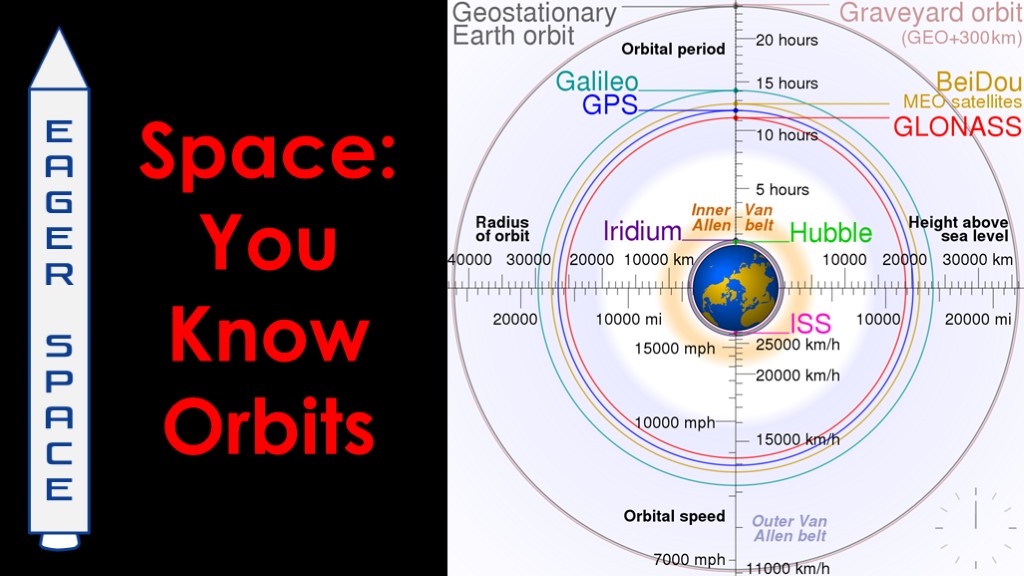
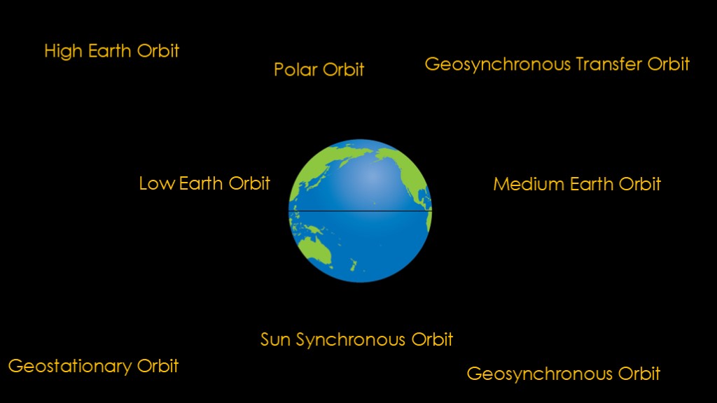
There are numerous orbits for satellites - enough that the topic can get confusing.
That's the point of this video - to get rid of that confusion.
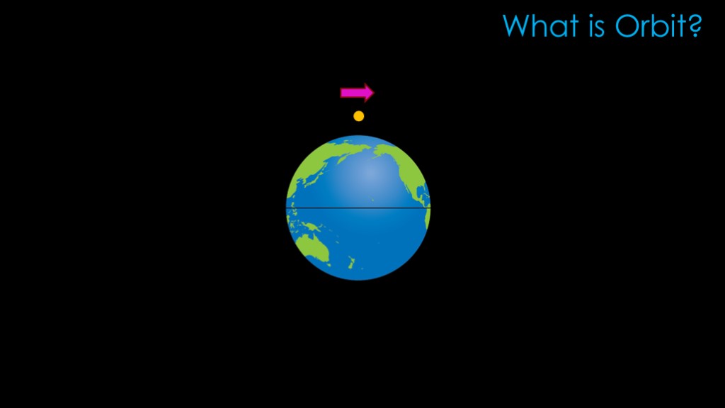
First we need to understand what it means to be in orbit. There's a classic thought experiment that works well.
If we have a body floating in space and give it a kick to the side, it will move to the side but the earth's gravity will soon pull it down so it crashes into the surface.
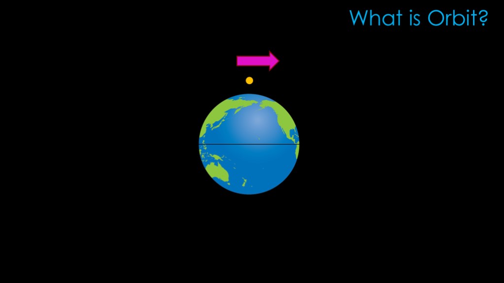
Give it a harder kick, and it goes farther around the earth before it hits the surface.
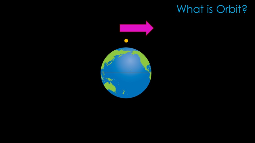
Give it just the right kick, and the satellite will go fast enough so that it falls towards the earth at the same rate the earth curves away from it. That is what it means to be in orbit
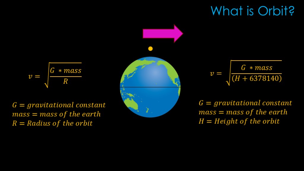
Here's a bit of math for those who like that sort of stuff.
The required velocity to stay in orbit is given by the following equation, where G is the gravitational constant, mass is the mass of the earth, and R is the radius of the orbit measured from the center of the earth.
The approach is a bit inconvenient because we measure orbits by how far they are above the surface, so there's an alternate version that uses the orbital height and adds in the radius of the earth, about 6.3 million meters.
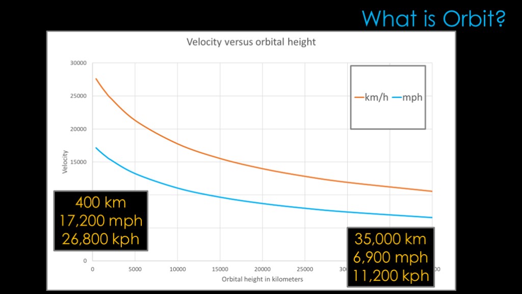
We can chart the speed at various altitudes.
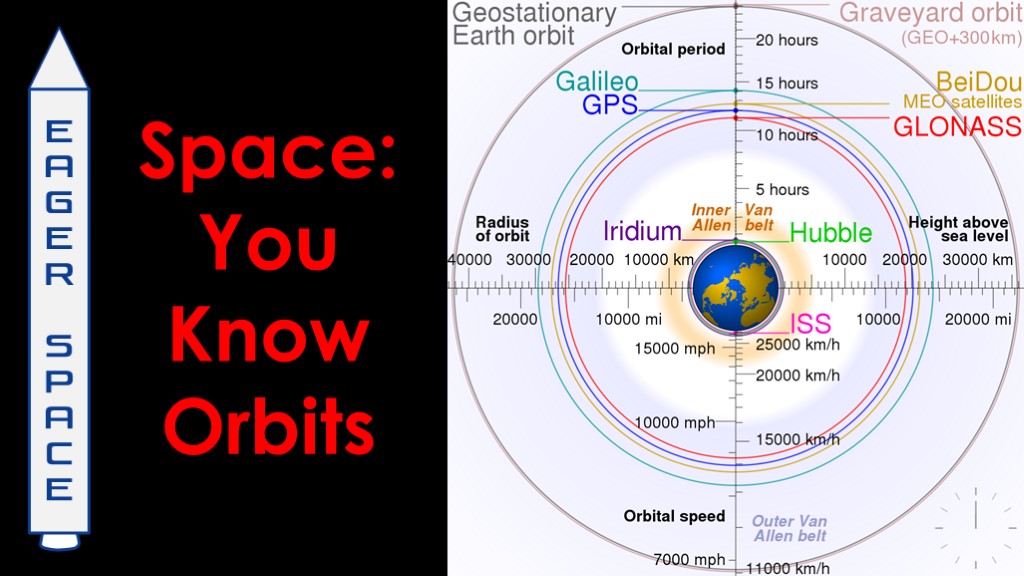
Way down at 400 kilometers, the orbital speed is around 17,200 miles per hour, or 26,800 kilometers per hour.
Out at 35,000 kilometers, it's 6900 miles per hour or 11,200 kilometers per hour - less than half of the velocity than it was at 400 kilometers.
The velocity goes down because the earth's gravity is reduced as we move away from it.
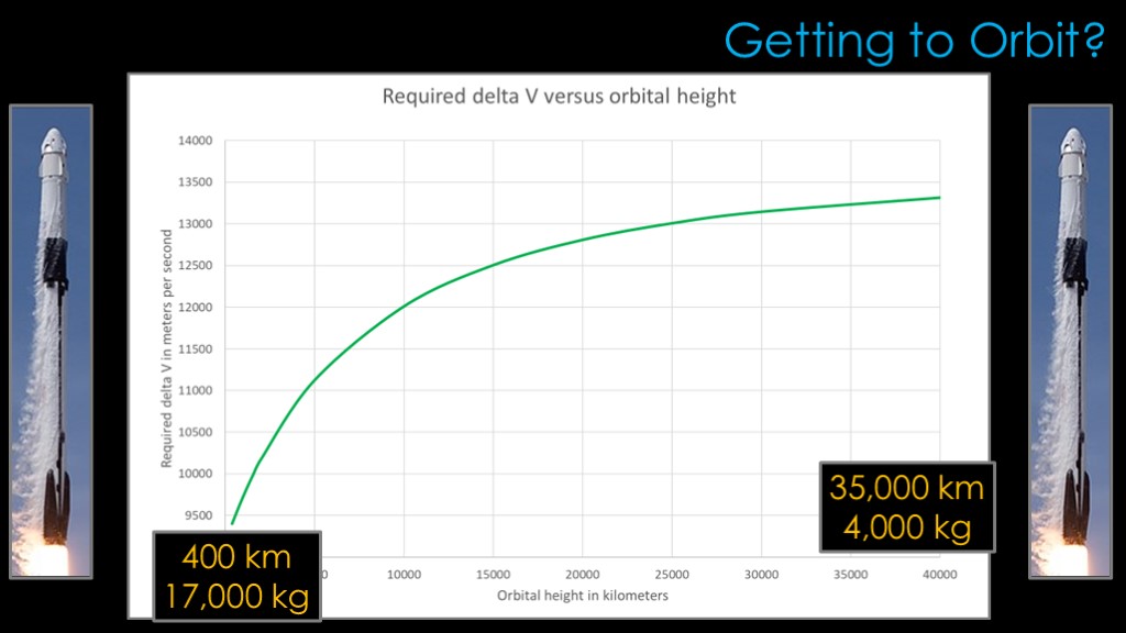
This graph demonstrates how difficult it is to get into various orbits...
Getting into a 400 kilometer orbit takes about 9400 meters per second of what is called delta v - the amount of work the rocket has to do. The Falcon 9 can carry around 17,000 kilograms in reusable mode to 400 kilometers.
Getting to higher orbits is much, much harder. Getting to 35000 kilometers takes over 13,000 meters per second of delta V, and that limits Falcon 9 to perhaps 4000 kilograms for that orbit.
Now we can dive into the details of an orbit.
There are three main factors that define an orbit - the altitude of an orbit, the inclination of an orbit, and the eccentricity of an orbit.
Altitude is the first factor
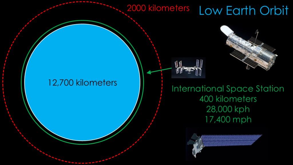
We'll start with low earth orbit. The earth is about 12,700 kilometers in diameter, so a low earth orbit of less than 2000 kilometers is pretty close to the earth's surface.
Low earth orbit is above most of the atmosphere but there is still enough atmosphere to slow satellites down, so the space station needs to be reboosted periodically to keep it from reentering the atmosphere.
This is also the orbital range where the hubble space telescope lives, at 560 kilometers, and the SpaceX starlink satellites, at 550 kilometers, 1150 kilometers, and 340 kilometers.
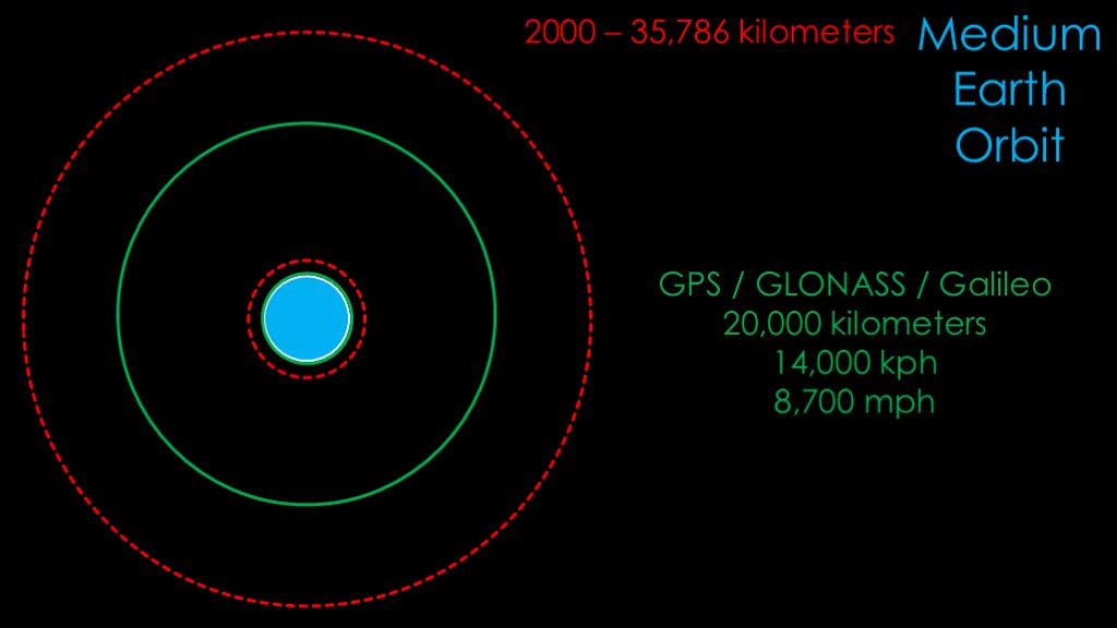
Medium earth orbit is a bit weird. It runs from the top of 2000 km all the way out to a very specific distance of 35,786 kilometers. More about that number in a minute...
Probably the most well-known satellites in this orbit are navigation satellites, with the US GPS system, the Russian Glonass system, and the European galileo system. All orbit at around 20,000 kilometers.
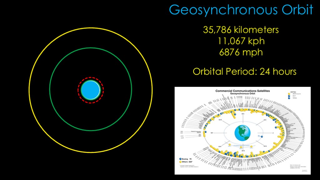
Geosynchronous orbit is at 35,786 kilometers of altitude, and has an orbital speed of 11,067 kilometers per hour or 6876 miles per hour.
At this altitude, the speed at which the satellite orbits is exactly the speed that the earth turns, which gives an orbital period of 24 hours, which is the definition of a geosynchronous orbit.
This is very convenient for communications satellites, and it turns out that there are over 500 of them in this orbit.
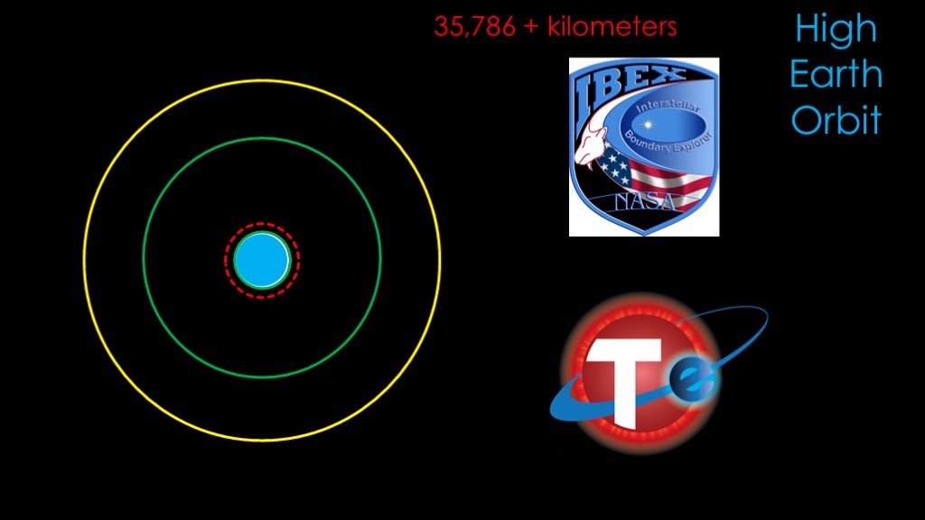
High earth orbit is geosynchronous orbit and beyond.
Two satellites in distant earth orbits are the interstellar boundary explorer, which looks at the interaction between the solar system and interstellar space, and the transiting exoplanet survey satellite - or TESS - searches for exoplanets.
Being in a distant earth orbit keeps the satellite close enough that it is easily interacted with but far enough away so the earth will not degrade the science.

The second orbital factor is inclination.
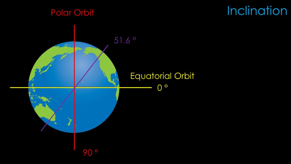
Inclination describes how tilted the orbit is compared to the earth's axis.
An orbit that goes directly around the equator of the earth is not surprisingly known as an equatorial orbit, and an orbit that goes over the earth's poles is known a polar orbit.
We would say that an equatorial orbit has an inclination of zero degrees, and a polar orbit has an inclination of 90 degrees.
There are inclinations between those two orbits - you might choose to launch to an inclination of 51.6 degrees. There are two big factors that drive the choice of inclination.
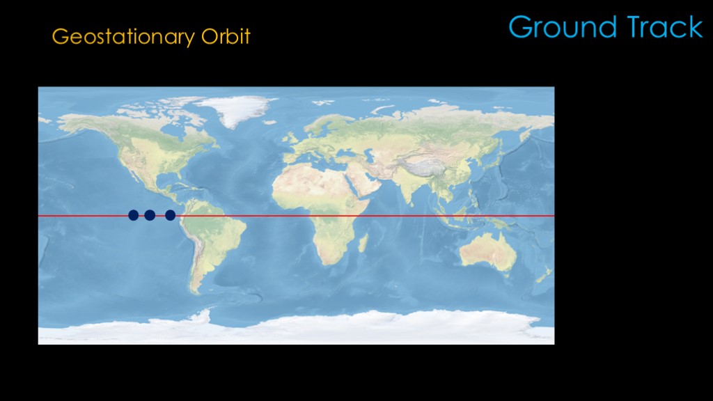
The first is ground track
Ground track simply defines the path that the satellite travels over the earth's surface.
Let's say that we want to provide TV service over North America. We need a fixed position so that our customers know where to point their satellite dishes, so we choose a geosynchronous orbit that has zero inclination - otherwise known as a geostationary orbit. The satellite orbits at the same rate that the earth turns, so from our ground perspective, it looks like it's just parked over a spot on the equator.
A company like Direct TV uses multiple geostationary satellites to serve different parts of north America.
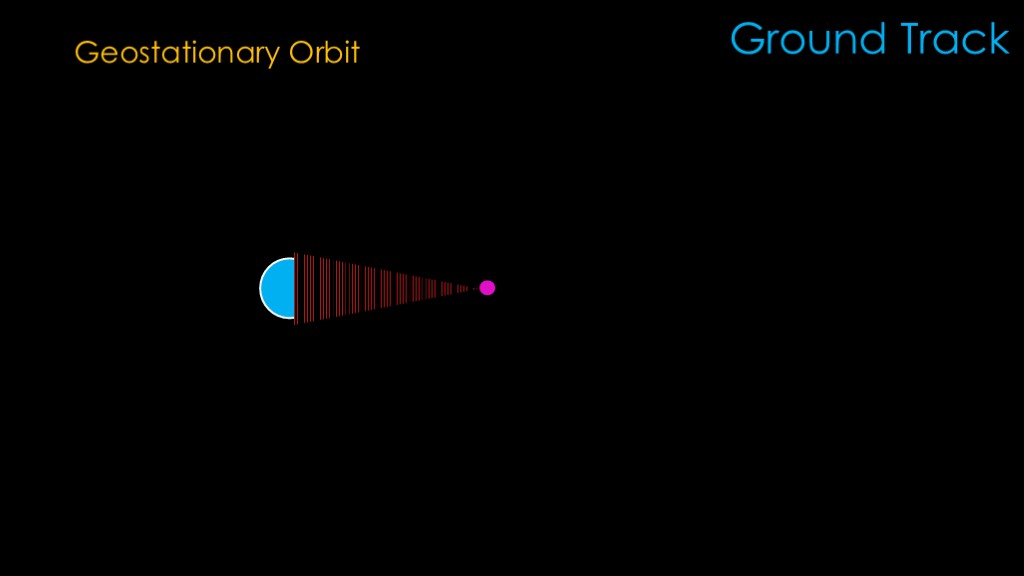
The geostationary orbit is a long way away from the earth, so the signal that it generates can reach most latitudes on the earth except for the poles, though the farther from the equator on earth, the more the dish needs to be tilted and the greater the likelihood there is an obstruction in the way. This prevents them from providing effective service at high latitudes.
The location of these satellites makes them poorly suited for earth observation - they only see one side of the earth and only from a long distance.
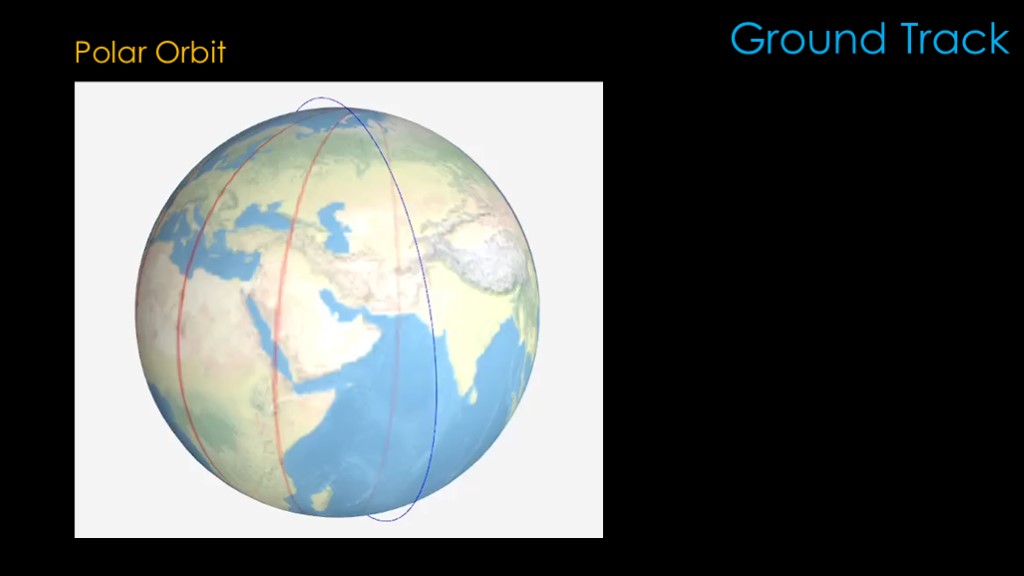
For earth observation, we want an orbit that covers most of the earth's surface, and that is a polar orbit.
The earth slowly spins underneath the satellite, and each orbit covers a different patch of the earth's surface.
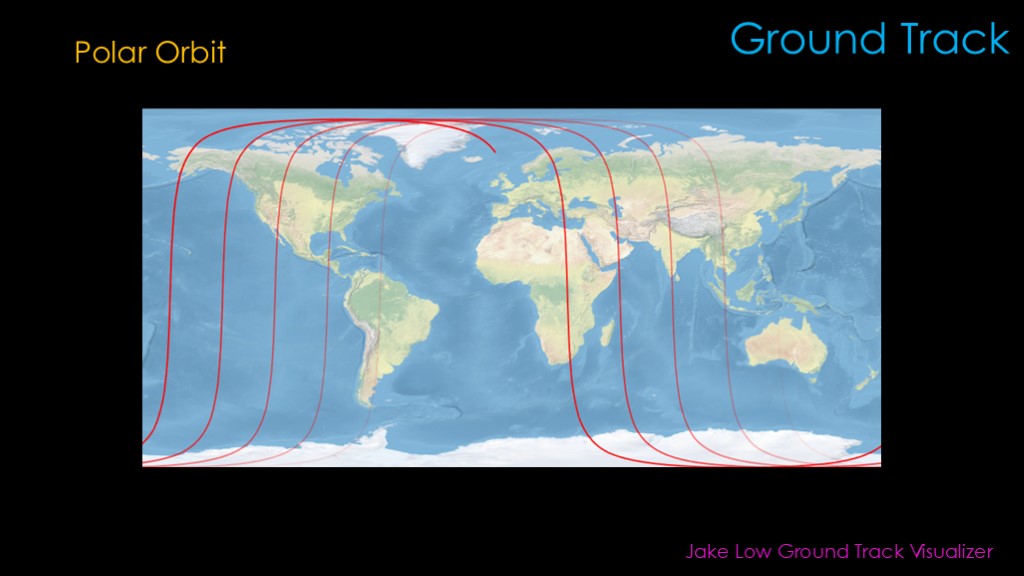
That leads to a ground track that looks like this.
Both the animation and this ground track were created by Jake Low's excellent ground track visualizer.
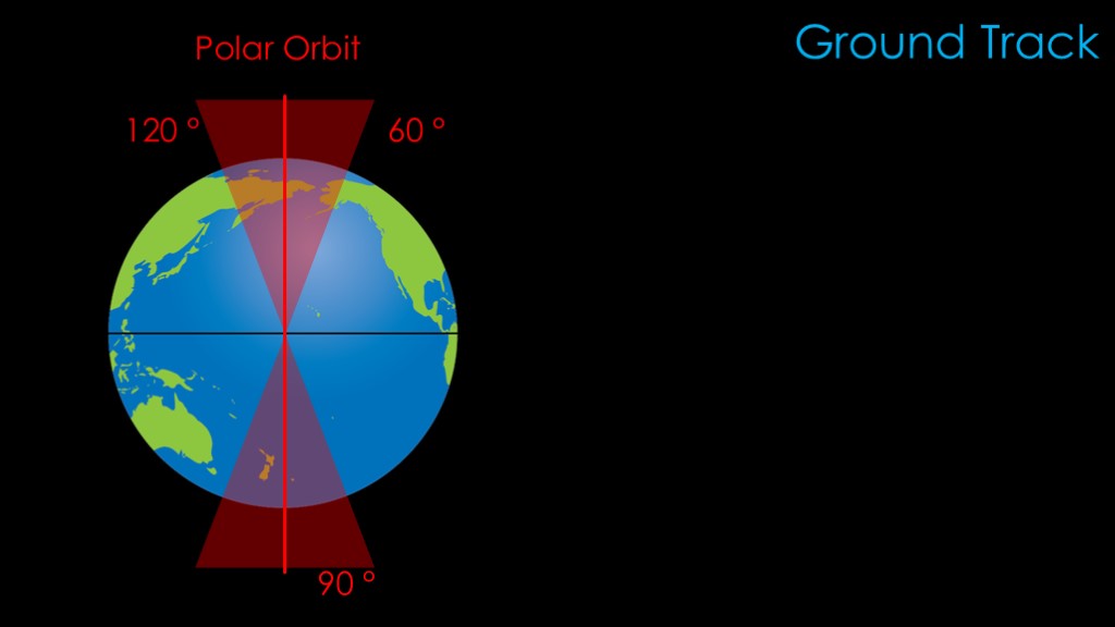
I said earlier that polar orbits were 90 degrees, but technically any orbit from 60 degrees to 120 degrees is a polar orbit.
The majority of earth observation satellites fly a very specific orbit known as a
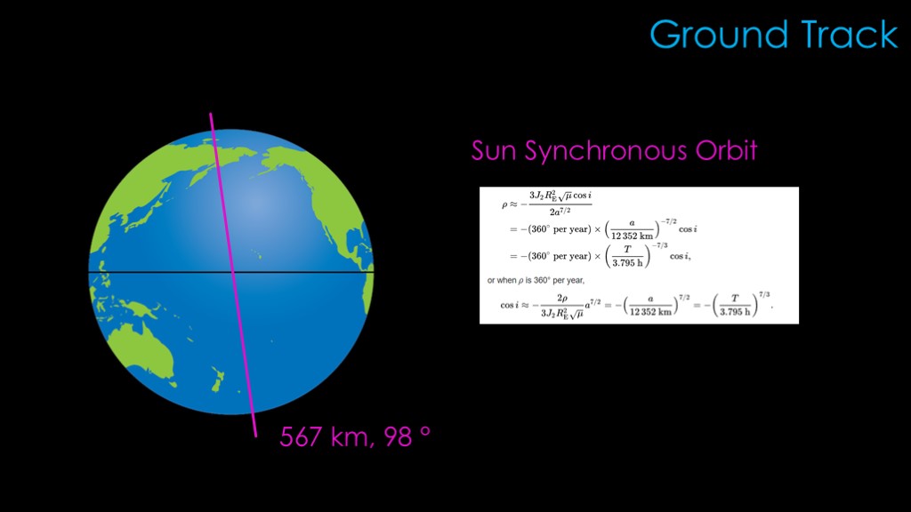
The majority of earth observation satellites fly a very specific polar orbit known as a "sun synchronous orbit".
Wikipedia will be happy to share with you all the complex details and math, but the basic concept is that the sun synchronous orbit is set up so that the orbit rotates - the technical term is "precesses" - about 1 degree eastward every day. That keeps the orbit synchronized with the sun so the satellite passes over any given point of the surface at the same local mean solar time.
This gives consistent lighting and that is hugely useful for any satellite that does imaging.
The most popular sun synchronous orbit is at 567 kilometers and an inclination of 98 degrees. It covers most of the earth's surface, provides 15 orbits per day, and high enough that the satellite will last in orbit for a long time.
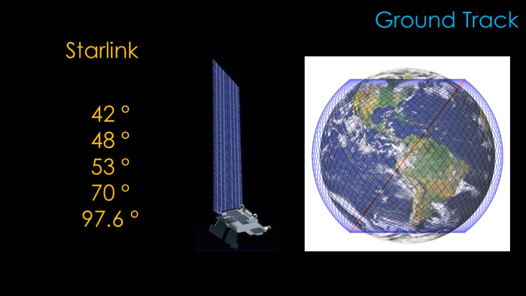
SpaceX's starlink uses a variety of inclinations, with satellites at 42 degrees, 48 degrees, 53 degrees, 70 degrees, and 97.6 degrees. They use this mix of inclinations to provide more satellite coverage where needed.
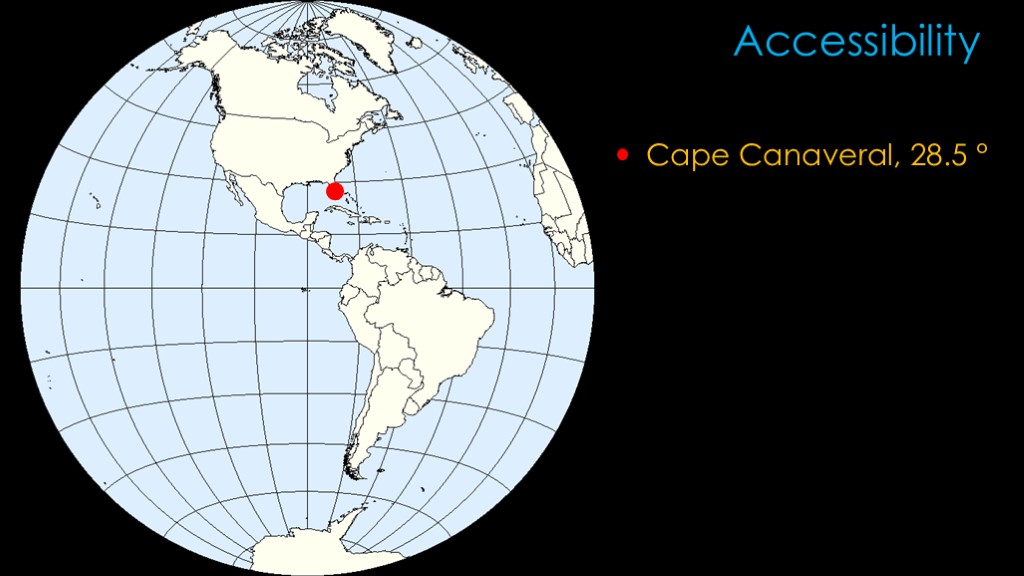
The second important factor for inclination has to do with the accessibility of orbits from a specific launch site.
Cape Canaveral in Florida has a latitude of 28.5 degrees north, and because of the way the physics works, that means the "natural" inclination for the launch site is 28.5 degrees of inclination.
It *is* possible to get to lower inclinations, but it takes quite a bit of energy to do so and that means less payload to orbit. This is especially true for low earth orbit because the orbital speeds are so much higher.
It's costly enough that it's common to say that it's not possible to launch to an inclination lower than the launch site's.
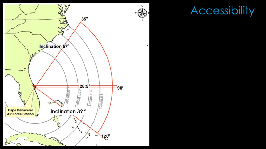
It is possible, however, to reach higher inclinations fairly easily simply by aiming to the north or south during launch. There is a reduction in payload to those orbits but it is much cheaper than launching to a lower inclination.
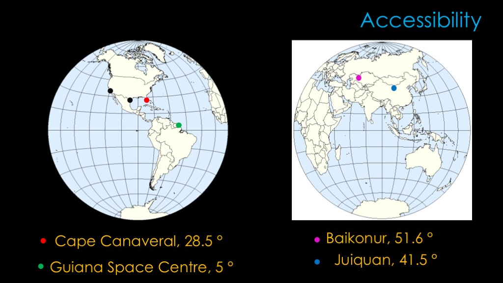
The accessibility of orbits has some significant impacts on international cooperation.
NASA launches from Cape Canaveral at 28.5 degrees, while the Russians launch from Baikonur in Kazakhstan at 51.6 degrees.
To make the international space station possible, it was placed at 51.6 degrees so that it was possible for both Russia and the United States to reach it. That inclination also has the advantage of covering more of the earth's surface.
China launches the taikonauts from Juiquan satellite center to an orbit at 41.5 degrees. There have been suggestions that Russia might stop collaborating with the ISS partners and start working with the Chinese, but because of the difference in inclinations, the Russians cannot reach the Chinese space station with Soyuz from Baikonur.
The European space agency launches from Guiana Space Center in French Guiana at an inclination of only 5 degrees. This is a very desirable location because it is so close to the equator, though dealing with the jungle conditions is challenging.
Because I know people will ask, SpaceX's boca chica launch site in Texas is at 26 degrees north. Vandenberg space force base in California is at 35 degrees north, but it is generally used for polar launches to the south where the natural latitude is much less important.
The final orbital factor is eccentricity
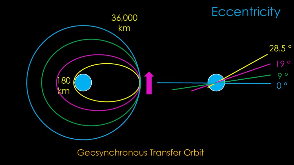
Let's look at launching a satellite to geostationary orbit.
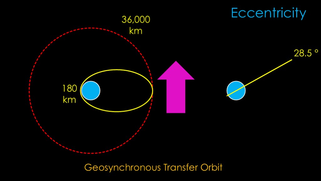
We start by launching to a very elliptical orbit, where the high point or apogee is all the way out at 36,000 kilometers and the lowest point or perigee is all the way down at 180 kilometers. This is known as a geosynchronous transfer orbit. The orbit is inclined at the latitude of our launch site.
We need to do two things to get to our final orbit.
First, we need to circularize our orbit - to raise the perigee so that it is the same as the apogee.
Second, we need to get rid of whatever inclination we got from our launch site.
We do this by thrusting in the direction of our orbit at the high point of the orbit, with a little correction to reduce the inclination. We do this at the high point of the orbit because that is the point where we are travelling the slowest and therefore it is the point where the cost of the inclination change is the smallest.
That puts us into a less inclined orbit with a higher perigee.
We will repeat that several times until we get to a circular orbit with no inclination.
This was the typical approach used by satellites.
Another technique is to use a really big rocket motor - typically the second stage motor itself - to make the required changes using a single burn.
The Department of Defense launches that go directly to geosynchronous orbit use this technique.
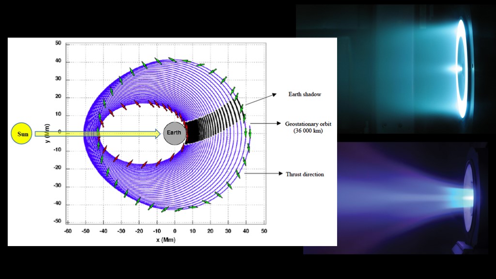
Most modern satellites use electric thrusters that are very efficient but have very low thrust.
Because of the low thrust, the orbit cannot be adjusted at the apogee; instead there is a complex approach where the thrust direction is changed throughout the orbit to achieve the desired orbit efficiently. It takes many orbits and months of time to complete this maneuver.
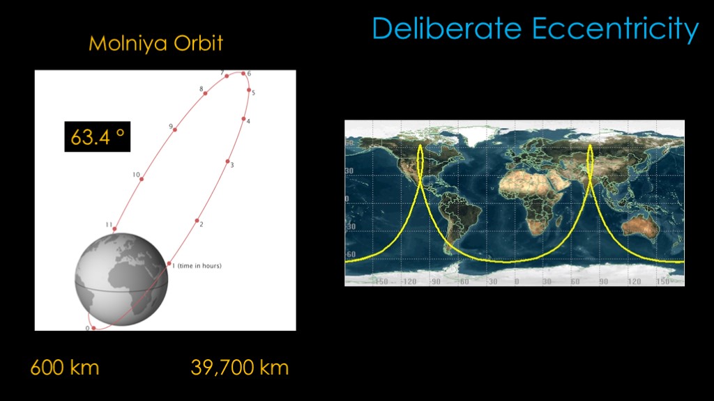
There are some satellites that are deliberately placed into a highly eccentric orbit. The Soviets and Russians have used an orbit known as Molniya for communications satellites since the mid 1960s as it provides good coverage at the high latitudes near the poles where geostationary satellites do not work well.
The orbit is inclined at 63.4 degrees. The height varies between missions, but a typical molniya orbit is very eccentric, with a perigee of 600 kilometers and an apogee all the way out at 39,700 kilometers.
The satellite travels much slower during the high part of its orbit and therefore spends most of its time over one hemisphere. Three satellites in this orbit can therefore provide continuous coverage.
The ground track of the molniya orbit is a bit weird. The satellite orbital period is 12 hours, so the ground track just alternates between two locations. Looking at the two locations, you can understand why both the soviets/Russians and the US are fond of this orbit for reconnaissance satellites.
One of the downsides of the molniya orbit is that the satellite will need to be designed to deal with the high radiation of the Van Allen belts every orbit.
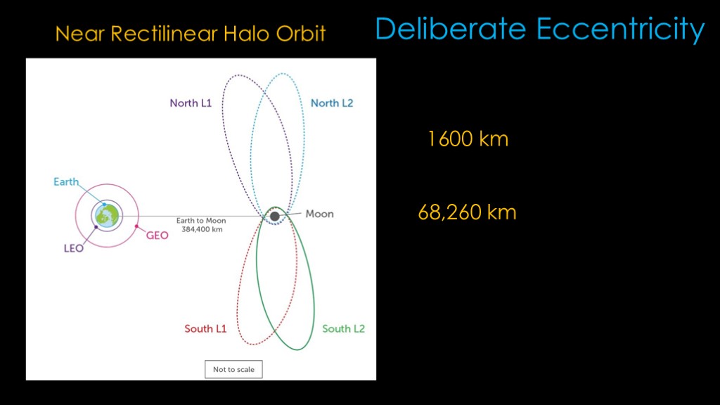
The near rectilinear halo orbit used on NASA's Artemis missions to the moon uses an highly eccentric orbit that is similar in concept to the Molniya orbit.
It has a closest point - known as perilune rather than perigee because the orbit is around the moon - of 1600 km, and a apolune of 68,260 km. This is a big orbit and the moon doesn't have a lot of gravity, so the orbital period is 6.5 days. That gives good coverage of the Artemis landing sites at the south lunar pole, though for continuous coverage multiple satellites would be needed.
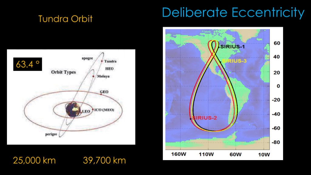
Probably the strangest orbit is the Tundra orbit.
It is much less elliptical than the molniya orbit, with a perigee of 25,000 kilometers and an apogee of 39,700 kilometers. This keeps it out of most of the radiation from the Van Allen Belts. It shares the 63.4 degree inclination that molniya uses.
You'll notice that apogee is a little bit higher than the apogee of a circular geosynchronous orbit, and the perigee is a bit lower.
You therefore shouldn't be surprised to find out that Tundra is a geosynchronous orbit - the orbital period is 24 hours. But it's not geostationary as the orbit is both highly inclined and eccentric.
That gives it a ground track that is frankly bizarre - a teardrop shape with a little loop in the high latitudes. Sirius Satellite radio used three satellites in this orbit to provide service to North America - at any time, two satellites were above the and they could therefore provide continuous service.
Tundra is generally a better choice than Molniya but it takes more energy to get there.
And that's all I wanted to cover, and now, you know orbits...

If you enjoyed this video, please explain the relevance of this image